
Understanding
Remote Sensing
MiniFrance: a database for semi-supervised learning in remote sensing
Javiera Castillo Navarro, Bertrand Le Saux (ESA), Sébastien Lefèvre (UBS/INRIA)
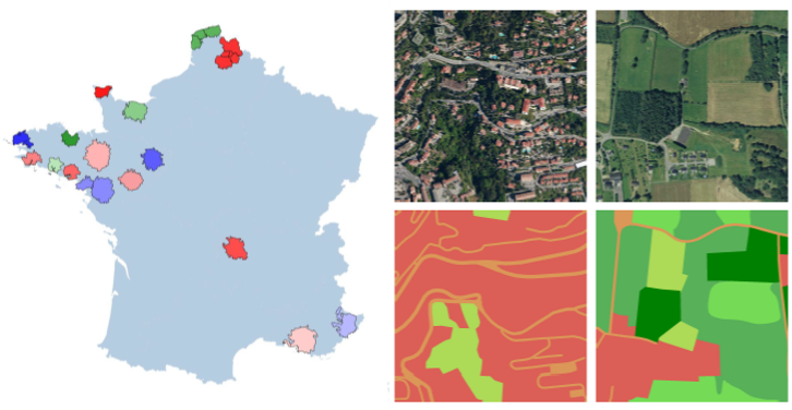 We introduce a novel large-scale dataset for semi-supervised semantic segmentation in Earth Observation, the MiniFrance suite. MiniFrance has several unprecedented properties: it is large-scale, containing over 2000 very high resolution aerial images, accounting for more than 200 billions samples (pixels); it is varied, covering 16 conurbations in France, with various climates, different landscapes, and urban as well as countryside scenes; and it is challenging, considering land use classes with high-level semantics. Nevertheless, the most distinctive quality of MiniFrance is being the only dataset in the field especially designed for semi-supervised learning: it contains labeled and unlabeled images in its training partition, which reproduces a life-like scenario.
[PDF] [Data]